A San Carlos Walk From Eaton Park to Pulgas Ridge, No Car Needed
November 19, 2026
November 19, 2026
At the Brittan Avenue end of the Eaton Trail, a steep stairway of 68 steps comes down between two houses. Its handrail is a rope. At the bottom are a park sign and a large mounted map, and directly across the street is the main entrance to Big Canyon Park. Walking Redwood City described that crossing in a September 2024 hike. The same walk kept going from Big Canyon to Crestview Park and then up to Pulgas Ridge Open Space Preserve.
Eaton Park, Big Canyon Park, Crestview Park and Pulgas Ridge form one chain, and you can start it on foot from a residential street. Since 2024 the city has added more entrances from neighborhood streets into that chain. Here's the route in order, followed by the newer entrances and the dates on the calendar this winter.
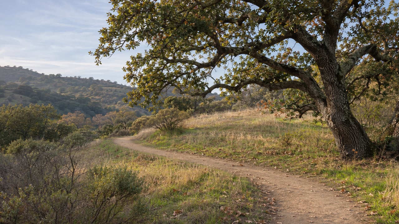
Eaton Park's trailhead sits near La Mesa Drive and Loma Road. Its natural trail climbs through oak and madrone woodland toward Loma Lane. The adopted 2026 San Carlos Parks Master Plan puts Eaton's trail network at about 3.57 miles. A local resident's White Oaks blog post from March 2026 lists entrances at Eaton Avenue, Tramanto Drive, Loma Road and Brittan Avenue. It describes the stretch from Eaton Avenue up toward Loma Road as a challenging climb with Bay Area views.
Your choice of entrance sets how much climbing you do. The Walking Redwood City account notes that the Loma Road entrance is already high in the hills. From anywhere else, expect to gain elevation. The trails are well maintained but narrow, unpaved and stepped in places, and the signs at junctions mostly give trail names only, so carry a map.
That 2024 route followed the Vista Trail along the park's eastern edge, climbed Hawk Hill to an elevation of 528 feet with a view northeast toward downtown Oakland, then took the Eaton Trail west to Brittan Avenue. In 2024 one section of the Eaton Trail showed storm washout, with plastic sheeting on the slope and a pipe diverting runoff, but the trail stayed open. The city has since reported that its landslide repair in Eaton Park, behind 3101 Brittan Avenue, is substantially complete. That repair was for damage from the 2022/23 winter storms.
The Big Canyon entrance is on the north side of the 3200 block of Brittan Avenue. The city describes its 1.2-mile trail as challenging and scenic, with views over San Carlos and the East Bay. Counting all its trails, the Master Plan puts Big Canyon's network at about 2.6 miles. At the entrance are a kiosk with a large map, a box of paper maps, a bench and a plaque for the U.S. Navy transport plane that crashed in these hills during World War II. Seven servicemen died in that crash and sixteen men survived.
The fork just inside the entrance decides the rest of the walk. The eastern branch dead-ends, so you have to come back the way you went in. To keep going, head west on the Harold Drake Trail, which is a loop. The Tank Trail branches off it and runs past two large water tanks. It ends at a short paved drive between two houses, and a brown "Big Canyon Park" sign there stands beside a crosswalk with flashing beacons.
That crosswalk takes you to Crestview Park, the one stop on the route with parking and restrooms. The park also has walking trails, a grass field, a playground, picnic areas and a pickleball and basketball court. The Walking Redwood City account calls the next leg "the long slog up Crestview Drive to its high point." The Pulgas Ridge entrance is a short way west of there, down Los Vientos Way.
The Los Vientos Way entrance is what lets the chain reach Pulgas Ridge on foot. San Carlos City Council acted on the access easement at the end of the street on September 11, 2023. The Midpeninsula Regional Open Space District board approved opening the entrance on February 14, 2024, and the city now lists it as open to hikers. According to Midpen's project filing with the state, the old chain-link fence and gate about 135 feet southwest of Best Court were replaced with a district gate and a pedestrian stile, and bike racks and signage were added. An existing trail links the street to the preserve's Dusky-footed Woodrat Trail. The project added no parking. The city asks visitors who drive there to keep the fire lane clear. When the Midpen board approved the entrance, The Almanac reported that neighbors had raised parking, traffic, noise and fire access, and that others supported the easier access.
The upper entrance is basic, with trash cans and a dog-bag dispenser. The main entrance below has more facilities: a gravel lot off Edmonds Road, two portable toilets, and signs with paper maps. If you walk in from Los Vientos, you skip the drive around to that lot.
Pulgas Ridge has about six miles of trails through canyons and over a ridge, with views of the Bay and the hills. From the top, the Walking Redwood City account looked south over neighboring Edgewood Park. According to Midpen, the Dusky-footed Woodrat Trail runs two miles and the Polly Geraci Trail one mile. Polly Geraci can be walked as an easy two-mile loop. The Cordilleras Trail is a gentle 0.8 miles to a bench beside Cordilleras Creek.
Near the center of the preserve is a signed 17.5-acre off-leash dog area. Back in town, the city lists the City Hall Dog Park, a 1.3-acre fenced off-leash area, and the 1.5-acre Heather Dog Exercise Area.
The two park systems close at nearly the same time. The city brochure gives Eaton and Big Canyon hours as 30 minutes before sunrise to 30 minutes after sundown. Pulgas Ridge closes half an hour after sunset.
Los Vientos Way was the first of several new entrances. The Master Plan, adopted by City Council on June 8, 2026, says the Devonshire Canyon trail proposed in the 2012 Hillside Trails Plan has been completed. That trail starts at Vista Park and switchbacks through a parcel called Lot G, then follows a public easement through privately owned open space. It's about a 0.75-mile out-and-back. Vista Park has walking trails, benches, picnic areas and wide Bay Area views, and the city says its plantings are native-only and pesticide-free.
Across town, the city put the Trillium Trailhead project out to bid in July 2026. It's a short connector that starts on the north side of Trillium Lane, about 470 feet from Club Drive. It joins an existing path to the Finch Trail in Belmont's Waterdog Lake and Hidden Canyon Park open space. The design calls for about 490 feet of hand-built tread, two feet wide, on native soil. Belmont lists Waterdog Lake and Open Space as open sunrise to sunset.
The Master Plan also lists future work along the main chain. For Big Canyon, it proposes a designated ADA trail at Brittan Avenue, a vista point at the end of the Oak Meadow Trail, wayfinding, and a restroom on Brittan Avenue with more wayfinding across the street at Eaton. For Eaton, it lists drainage and erosion work on the Eaton, Vista, Summit and Hawk Hill trails, closing informal trails and an updated trail map. Each of these is a recommendation in a plan that runs through 2045, not a construction schedule.
Midpen has a guided winter hike at Pulgas Ridge on Wednesday, December 2. It covers about 4.25 miles on the Blue Oak, Dick Bishop and Dusky-footed Woodrat trails, with about 600 feet of climbing, and dogs aren't allowed. If you'd rather work on the trails, Midpen has a volunteer day on December 10 to remove and replace a bench on the Blue Oak Trail. The district rates it strenuous and requires advance registration. Down the hill, San Carlos holds its Night of Holiday Lights on Laurel Street on Friday, December 4.
For more on the city, see our San Carlos neighborhood guide. If you'd like to know which San Carlos streets are closest to these trail entrances, or what your home near the hills is worth today, Matt Aragoni can walk you through it. Get a free home valuation or schedule a consultation.
Stay up to date on the latest real estate trends.
I am your San Mateo County Real Estate Expert, growing up San Mateo County has given me a highly specialized insight into the local markets here. I provide my clients/network with the most up-to-date market info, local expertise, and 5 Star Quality Client Service.